Callback

We're happy to call you!

Searchfor room

orNon-binding enquiry

Information on Hiking, Trail Closures, Conduct, and Safety in the Mountains

Tips and Information for Your Mountain Experience

Find out about proper conduct in the mountains, how to interact with grazing animals, important emergency numbers, difficulty levels of hiking trails, and behavior rules on alpine pastures. Prepare yourself, ensure your safety, and enjoy your vacation in Kufsteinerland.

Closed Trails & Tours

BAD HÄRING: Bergbau-Kohle themed trail currently closed due to flooding

Due to flooding, a section of Agstraße and the adjacent hiking trail is closed. This also affects the Bergbau-Kohle themed trail.
There is no detour available.


Forest-wild-bees-theme-trail

Forest-wild-bees-theme-trail

Exciting Route with 10 stations about the life of bees in the Thiersee valley!

  • Type: Hiking
  • Start: Bienenalm
  • End: Starting point
  • Easy
  • 0:50 h
  • 68 m
  • 2.7 km


Walking Tour Thiersee

Walking Tour Thiersee

Nice and short circuit around the Thiersee.

  • Type: Hiking
  • Start: information office Thiersee
  • End: = starting point
  • Easy
  • 1:00 h
  • 79 m
  • 3.6 km


St. Nikolaus Round

St. Nikolaus Round

Starting in the centre of Ebbs, right next to the cathedral, this tour takes you to the idyllic hamlets of Ebbs. The path along woods, meadows and farms culminates in a panoramic view from the small...

  • Type: Hiking
  • Start: Church of Ebbs
  • End: Church of Ebbs
  • Easy
  • 2:30 h
  • 180 m
  • 9.2 km


Legend trail - Brentenjoch tour

Legend trail - Brentenjoch tour

Three stations invite you to walk through the legends around the Brentenjoch.

  • Type: Hiking
  • Start: Car park Kaiserlift
  • End: Car park Kaiserlift
  • Medium
  • 3:00 h
  • 363 m
  • 8.5 km


Sensory experience

Sensory experience

ATTENTION: The station "Schwefelquelle" is currently under reconstruction. At various stations in the middle of nature, the senses are sharpened while you are gently immersed in nature. For more...

  • Type: Hiking
  • Start: Kirchplatz / Bad Häring
  • End: Kurpark / Bad Häring
  • Easy
  • 1:30 h
  • 49 m
  • 3.0 km


2-day mountain tour Güttlersteig to Sonneck

2-day mountain tour Güttlersteig to Sonneck

Difficult 2-day mountain tour from Kufstein with the Kaiserlift over the Güttlersteig with surefootedness to Sonneck and overnight stay in the Kaisertal (Anton-Karg-Haus or Hans-Berger-Haus)

  • Type: Hiking
  • Start: Kaiserlift valley station
  • End: Kaiseraufstieg
  • Difficult
  • 12:30 h
  • 2330 m
  • 15.0 km


Historic city trail

Historic city trail

Welcome to Kufstein! The Historic Town Trail leads to 23 stations around the fortress mountain and at the same time across the dazzling history of Kufstein.

  • Type: Hiking
  • Start: Marienbrunnen
  • End: Unterer Stadtplatz
  • Easy
  • 1:00 h
  • 15 m
  • 1.7 km


Legend trail - Village tour Erl

Legend trail - Village tour Erl

Three stations invite you to walk through the Erler legends.

  • Type: Hiking
  • Start: Car park Passions/Festival Theatre
  • End: Car park Passions/Festival Theatre
  • Easy
  • 0:40 h
  • 10 m
  • 2.3 km


Winter walk around Niederndorf

Winter walk around Niederndorf

The wintery Niederndorf invites you to take a short walk around the tranquil village and shines with enchanting views of the surrounding villages.

  • Type: Hiking
  • Start: Parking School Centre/ Sports ground
  • End: Parking School Centre/ Sports ground
  • Easy
  • 1:45 h
  • 145 m
  • 5.0 km


Winter hike with Scheffauer view

Winter hike with Scheffauer view

Starting in the centre of the Schwoich, this is a wonderfully pleasant walk across the quiet and remote hamlets of the village with fantastic views of the Scheffauer.

  • Type: Hiking
  • Start: Soccer field Schwoich
  • End: Soccer field Schwoich
  • Easy
  • 1:15 h
  • 80 m
  • 4.2 km


Winter walk around Kufstein

Winter walk around Kufstein

The wintry little town of Kufstein shows itself from its most beautiful side during this walk. Through settlements, along the forest and along the Inn river, you discover Kufstein in the cold season.

  • Type: Hiking
  • Start: Marienbrunnen Kufstein Center
  • End: Marienbrunnen Kufstein Center
  • Easy
  • 1:45 h
  • 33 m
  • 7.5 km


Winter circular trail around Kruhbichl

Winter circular trail around Kruhbichl

Leisurely winter hike to Gasthof Wachtl and back through the idyllic winter forest.

  • Type: Hiking
  • Start: Information office Vorderthiersee
  • End: Information office Vorderthiersee
  • Easy
  • 1:30 h
  • 162 m
  • 5.6 km


Summit tour ice cave

Summit tour ice cave

Conditionally challenging day hike to the ice cave. The peaks along the ridge reward you for your efforts with fantastic views. In addition, the ice cave is a real highlight that should not be missed.

  • Type: Hiking
  • Start: Centre of Niederbreitenbach
  • End: Centre of Niederbreitenbach
  • Medium
  • 8:30 h
  • 1372 m
  • 17.7 km


Kranzhorn Erl

Kranzhorn Erl

Varied mountain hike with wonderful views of the Chiemgau Alps and the Kaiser Mountains. The German/Austrian border runs over the Kranzhorn summit, which is why the climb is (unusually) rewarded with...

  • Type: Hiking
  • Start: parking Kranzhorn
  • End: summit Kranzhorn
  • Medium
  • 3:30 h
  • 498 m
  • 8.8 km


Trainsjoch Circuit

Trainsjoch Circuit

The round tour via Saurüssel, Ascherjoch and Trainsjoch offers wonderful quiet paths combined with challenging climbs.

  • Type: Hiking
  • Start: Parking Ursprung
  • End: Parking Ursprung
  • Medium
  • 5:30 h
  • 925 m
  • 11.3 km


Sunny side hikingtour Kaiser valley

Sunny side hikingtour Kaiser valley

This day walk leads up the 280 steps of the Kaiseraufstieg to what was in 2016 selected as the most beautiful place in Austria – the Kaisertal. After the steep ascent either Ritzau...

  • Type: Hiking
  • Start: Parking Kaisertalaufstieg
  • End: Starting point
  • Medium
  • 7:00 h
  • 1120 m
  • 15.0 km


Two days tour Wilder Kaiser

Two days tour Wilder Kaiser

The conservation area of the Wild Kaiser is one of the most beautiful hiking and climbing areas of Tyrol.

  • Type: Hiking
  • Start: Going bathing lake
  • End: Kaiseraufstieg
  • Difficult
  • 15:57 h
  • 2475 m
  • 42.5 km


Dream factory theme trail

Dream factory theme trail

This trail takes you to the local film studios and around Lake Thiersee.In the post-war era, the Thierseetal valley was the setting for numerous feature films. The trail starts at the Passion...

  • Type: Hiking
  • Start: Music Pavilion
  • End: Music Pavilion
  • Easy
  • 2:00 h
  • 129 m
  • 7.1 km


Mining & Coal theme trail

Mining & Coal theme trail

Bad Häring is not only known far beyond the borders of Tyrol as the first health resort - the town, situated on a plateau, can also look back on a past rich in tradition in mining and miners.

  • Type: Hiking
  • Start: Church square Bad Häring
  • End: Mining Museum
  • Medium
  • 2:00 h
  • 171 m
  • 5.2 km


Around the Aschingeralm

Around the Aschingeralm

Short circular hike around the Aschingeralm with breathtaking views.

  • Type: Hiking
  • Start: Aschingeralm
  • End: Aschingeralm
  • Easy
  • 0:45 h
  • 121 m
  • 2.9 km


Spitzstein Circuit

Spitzstein Circuit

Foresights into the Inn Valley and dreamlike views are awaiting you on this average mountain hiking tour.

  • Type: Hiking
  • Start: Hiking parking lot Erlerberg
  • End: Hiking parking lot Erlerberg
  • Difficult
  • 5:30 h
  • 770 m
  • 12.5 km


Stallhäusl Circuit

Stallhäusl Circuit

Circular hike through meadows and forests and along the Söller Sunnseitweg to the alpine guesthouse Stallhäusl.

  • Type: Hiking
  • Start: Church Bad Häring
  • End: Church Bad Häring
  • Medium
  • 4:15 h
  • 570 m
  • 11.8 km


Legend trail - Bad Häring tour

Legend trail - Bad Häring tour

Five stations invite you to walk through the Bad Häringer legends.

  • Type: Hiking
  • Start: Village centre Bad Häring
  • End: Village centre Bad Häring
  • Easy
  • 2:00 h
  • 180 m
  • 6.3 km


Two day tour - Höhenweg Zahmer Kaiser

Two day tour - Höhenweg Zahmer Kaiser

The high route leading from Vorderkaiserfeldenhütte to Stripsenjochhaus was former called "Sunkaiser-high route" because it leads along the south face of the mountain range. If you decide to hike...

  • Type: Hiking
  • Start: Ebbs
  • End: Ebbs
  • Medium
  • 13:15 h
  • 2100 m
  • 30.0 km


Snowshoe hiking Ebbs

Snowshoe hiking Ebbs

Experience the winter scenery in Ebbs on snow shoes.

  • Type: Hiking
  • Start: Parking lot Municipal office
  • End: Parking lot Municipal office
  • Medium
  • 3:30 h
  • 346 m
  • 6.6 km


Snowshoe evening hike Thiersee

Snowshoe evening hike Thiersee

Romantic through the calm and snow covered winter forest.

  • Type: Hiking
  • Start: Tennis court Hinterthiersee
  • End: Village center Hinterthiersee
  • Easy
  • 1:30 h
  • 62 m
  • 1.8 km


Snowshoe hiking Erl

Snowshoe hiking Erl

Winter. Snow. Hiking. A nice snowshoe hiking tour in Erl combines everything to a dreamlike experience.

  • Type: Hiking
  • Start: Primary schools
  • End: Car park Unterscheiben
  • Easy
  • 2:00 h
  • 142 m
  • 3.2 km


Mariandlalm Thiersee

Mariandlalm Thiersee

Winter hiking in Thiersee with a cozy alpine cabin to stop by and grab something to eat.

  • Type: Hiking
  • Start: Parking Ursprungpass
  • End: Mariandlalm
  • Medium
  • 2:00 h
  • 432 m
  • 3.2 km


Walleralm

Walleralm

Scenic hiking tour from Egerbach uphill to the rustic alp village.

  • Type: Hiking
  • Start: Bus stop Egerbach
  • End: Bus stop Egerbach
  • Medium
  • 5:00 h
  • 721 m
  • 11.2 km


Wäschkogel Circuit

Wäschkogel Circuit

Beautiful hike with a view to the icy ravine of the Glemmbach.

  • Type: Hiking
  • Start: Village center Hinterthiersee
  • End: Village center Hinterthiersee
  • Medium
  • 2:30 h
  • 286 m
  • 6.4 km


Kala Alm Thiersee

Kala Alm Thiersee

If at day or in the evening - enjoy the winter scenery in Thiersee on the lighted hiking and sledging track.

  • Type: Hiking
  • Start: Parking Guesthouse Schneeberg
  • End: Kala Alm
  • Medium
  • 2:00 h
  • 478 m
  • 3.1 km


Summit hike Pendling

Summit hike Pendling

Medium mountain tour with beautiful views into the Inn Valley.

  • Type: Hiking
  • Start: parking lot Gasthof Schneeberg
  • End: parking lot Gasthof Schneeberg
  • Medium
  • 4:00 h
  • 600 m
  • 8.6 km


Jakobsweg Tyrol

Jakobsweg Tyrol

Beginning with the european culture the believers began to go on pilgrimages. Every year thousands of pilgrims start off to walk a passage of the Way of St. James (Jakobsweg), to pilgrim, to reflect...

  • Type: Hiking
  • Start: Kiefersfelden border Germany/ Tyrol
  • End: Wörgl/ Glatzham
  • Easy
  • 6:00 h
  • 219 m
  • 20.8 km


Haflinger circuit Ebbs

Haflinger circuit Ebbs

Hiking to discover the beautiful villages in the Kufsteinerland. Visit the lively Haflingers in Ebbs on the cosy village tour.

  • Type: Hiking
  • Start: Center of Ebbs/Curch
  • End: Starting point
  • Easy
  • 0:50 h
  • 24 m
  • 3.7 km


Oberndorf Circuit

Oberndorf Circuit

With a constant view of the Tame Emperor, they walk through the village of Ebbs and its surroundings. The path leads along meadows and forests from the village centre to the idyllic district of...

  • Type: Hiking
  • Start: Ebbs Church
  • End: Ebbs Church
  • Easy
  • 1:00 h
  • 21 m
  • 5.1 km


Eco culture route Niederndorferberg

Eco culture route Niederndorferberg

The cross-border Eco culture route should bring closer the interaction of nature, farming and culture of a through mountain farming stamped alpine region.

  • Type: Hiking
  • Start: Sennerei Hatzenstädt
  • End: Sennerei Hatzenstätt
  • Easy
  • 2:00 h
  • 159 m
  • 5.9 km


Energy trail

Energy trail

6 stations along the trail in Kufstein help to gain new energy.

  • Type: Hiking
  • Start: Motivity park
  • End: Motivity park
  • Easy
  • 2:30 h
  • 411 m
  • 7.1 km


Culinary route - cheese and herbs at the Alpine dairy

Culinary route - cheese and herbs at the Alpine dairy

A walk in the Zahmer Kaiser is worth it for the backdrop alone. And the spread made of Alpine herbs you have collected yourself and a piece of soft alm cheese are a great reward for the climb.

  • Type: Hiking
  • Start: Gasthof Kölnberg
  • End: Aschingeralm
  • Easy
  • 1:10 h
  • 139 m
  • 3.5 km


A - Relaxed cycling in the Untere Schranne

A - Relaxed cycling in the Untere Schranne

This leisurely tour into the Untere Schranne offers delights for both the eye and the palate. The Haflinger village of Ebbs beckons with its cathedral and animal experiences, Niederndorf has plenty...

  • Type: Cycling
  • Start: Anywhere along the route / Kufstein
  • End: Anywhere along the route / Kufstein
  • Easy
  • 100 m
  • 28.3 km


01 - In the footsteps of the UCI World Cycling Championships

01 - In the footsteps of the UCI World Cycling Championships

The year 2018 in Kufstein was dedicated entirely to roadbiking. If you want to experience the tracks of the UCI Road World Championship just like the pros, this section through the Inn Valley offers...

  • Type: Cycling
  • Start: Kufstein city centre
  • End: Kufstein city centre
  • Medium
  • 1400 m
  • 149.0 km


05 - Sudelfeld circuit

05 - Sudelfeld circuit

Kings of the mountains really get to pick up the pace on the Tatzelwurm and many will take the time to enjoy the views.

  • Type: Cycling
  • Start: Kufstein city centre
  • End: Kufstein city centre
  • Medium
  • 929 m
  • 56.6 km


01A - Lake circuit - Brandenberg variant

01A - Lake circuit - Brandenberg variant

The additional 600 metres in altitude gain of this extension to the lake circuit promise nature and mountain views of the highest order.

  • Type: Cycling
  • Start: Kufstein city centre
  • End: Kufstein city centre
  • Medium
  • 971 m
  • 90.8 km


07 - World Cup circuit: Bavaria-Tyrol

07 - World Cup circuit: Bavaria-Tyrol

The race course for the World Masters Games Kössen-St. Johann is a moderately difficult course through woodlands and fields.

  • Type: Cycling
  • Start: Kufstein Unterer Stadtplatz
  • End: Kufstein Unterer Stadtplatz
  • Medium
  • 650 m
  • 88.0 km


12 - Krimmler Waterfalls

12 - Krimmler Waterfalls

This day tour through the Krimmltal, Gerlostal and Zillertal valleys packs a punch and puts your endurance and muscles to the test. The tour is recommendable in any case during the week, since the...

  • Type: Cycling
  • Start: Kufstein city centre
  • End: Kufstein city centre
  • Difficult
  • 2222 m
  • 199.0 km


06 - High mountain valley tour

06 - High mountain valley tour

An easy tour proceeding in a southerly direction through little Tyrolean villages and a turning point that tempts you to stay for a while.

  • Type: Cycling
  • Start: Kufstein Unterer Stadtplatz
  • End: Kufstein Unterer Stadtplatz
  • Medium
  • 1040 m
  • 81.0 km


10 - The big Chiemgau circuit

10 - The big Chiemgau circuit

A day tour through the Alpine foothills with no major gradients and which requires a good level of basic endurance.

  • Type: Cycling
  • Start: Kufstein Unterer Stadtplatz
  • End: Kufstein Unterer Stadtplatz
  • Medium
  • 723 m
  • 176.1 km


13 - Glockner tour

13 - Glockner tour

One of the hardest ascents in the Alps – the ride on the Großglockner high alpine road. Speed, views of the glaciers and the feeling that you are sailing across the Alps using pure muscle power,...

  • Type: Cycling
  • Start: Kufstein city centre
  • End: Kufstein city centre
  • Difficult
  • 4040 m
  • 298.9 km


06B - High valley tour Horler Stiegl

06B - High valley tour Horler Stiegl

This option turns off early to Horler Stiegl. The peaceful alpine landscape rewards for the 15 % climbs.

  • Type: Cycling
  • Start: Kufstein Unterer Stadtplatz
  • End: Kufstein city centre/ Lower Town Square
  • Medium
  • 1300 m
  • 74.0 km


10A - Wildbichl/ Aschau variant

10A - Wildbichl/ Aschau variant

Somewhat shorter yet with more incline, this option leads through peaceful Aschau in Chiemgau.

  • Type: Cycling
  • Start: Kufstein city centre
  • End: Kufstein city centre
  • Medium
  • 779 m
  • 165.7 km


06A - Alpine valley circuit variant

06A - Alpine valley circuit variant

The way back along this option leads past Söll and Eiberg. A minimally shorter return leg in rewarding surroundings.

  • Type: Cycling
  • Start: Kufstein city centre
  • End: Kufstein city centre
  • Medium
  • 1348 m
  • 79.0 km


08 - Pillersee circuit

08 - Pillersee circuit

The Pillersee circuit combines a wonderfully broken route with a dreamy backdrop. There are a few short yet steep climbs which are tough.

  • Type: Cycling
  • Start: Kufstein city centre
  • End: Kufstein city centre
  • Difficult
  • 1124 m
  • 134.6 km


11 - Kitzbühler Horn

11 - Kitzbühler Horn

Anyone who wants to tackle this very difficult and long tour on Austria’s ‘Alpe d`Huez’ has to have some mountain gear on the bike and strong legs.

  • Type: Cycling
  • Start: Kufstein city centre
  • End: Kufstein city centre
  • Difficult
  • 1863 m
  • 129.8 km


VT1 Lake-Tour

VT1 Lake-Tour

Winterwonderland Thiersee Valley. Explore the dreamlike winter scenery on the Lake-Tour in Vorderthiersee.

  • Type: Cross-country skiing, classic cross-country skiing, cross-country skating
  • Start: Lido Thiersee
  • End: Lido Thiersee
  • Easy
  • 1.6 km


BH3 Panorama cross-country ski trail

BH3 Panorama cross-country ski trail

The cross-country trail lives up to its name. On the almost 6-kilometer-long loop, you always have beautiful views of the Inn Valley and, on the other hand, of the Pölven.

  • Type: Cross-country skiing, classic cross-country skiing, cross-country skating
  • Start: Parking lot Panoramaloipe/ Schönauer Straße
  • End: Parking lot Panoramaloipe/ Schönauer Straße
  • Medium
  • 36 m
  • 5.9 km


EB1 Village-Tour

EB1 Village-Tour

You've never been on skis before? No problem! The Dorfloipe in Ebbs is great for beginners.

  • Type: Cross-country skiing, classic cross-country skiing, cross-country skating
  • Start: Saliterergasse Ebbs
  • End: Saliterergasse Ebbs
  • Medium
  • 84 m
  • 9.6 km


KU1 Weissach I

KU1 Weissach I

Enjoy the winter landscape in Kufstein on a varied network of cross-country ski trails.

  • Type: Cross-country skiing, classic cross-country skiing, cross-country skating
  • Start: Locherer Weg/ Hochwachtstraße
  • End: Locherer Weg/ Hochwachtstraße
  • Easy
  • 44 m
  • 2.5 km


NI2 Jennbach-Tour

NI2 Jennbach-Tour

Get to know the village Niederndorf and its drealike winter scenery on the 4 kilometres long track.

  • Type: Cross-country skiing, classic cross-country skiing, cross-country skating
  • Start: Parking lot Jennbach at the Forstmeile, Niederndorfer Landstraße
  • End: Parking lot Jennbach at the Forstmeile, Niederndorfer Landstraße
  • Easy
  • 10 m
  • 5.3 km


SC5 Schwoich cross-country skiing trail

SC5 Schwoich cross-country skiing trail

Cross-country skiing fans will get their money's worth on this extensive cross-country skiing circuit around Schwoich almost as far as Bad Häring.

  • Type: Cross-country skiing, classic cross-country skiing, cross-country skating
  • Start: Soccer field Schwoich
  • End: Soccer field Schwoich
  • Medium
  • 104 m
  • 8.0 km


HT3 Gruber-Tour

HT3 Gruber-Tour

Beautiful winter scenery in the Thiersee Valley. Enjoy the winter landscape on the cross-country ski slope.

  • Type: Cross-country skiing, classic cross-country skiing, cross-country skating
  • Start: Hinterthiersee village center
  • End: Hinterthiersee village center
  • Medium
  • 52 m
  • 2.2 km


KU6 Morsbach I

KU6 Morsbach I

On the western side of Kufstein is this easy trail suitable for beginners.

  • Type: Cross-country skiing, classic cross-country skiing, cross-country skating
  • Start: Kufstein Riding and Driving Club
  • End: Kufstein Riding and Driving Club
  • Easy
  • 0.7 km

KUFSTEIN: Connection Tischoferhöhle to Theaterhütte Closed

The connection from Tischoferhöhle via the Kaiserbach Bridge to Theaterhütte is closed until further notice due to storm damage. The path to Tischoferhöhle is accessible via the detour (Kaiserlift parking lot and Kaiser ascent).

The following tours are affected:


KOASA Jubilee Ultratrail

KOASA Jubilee Ultratrail

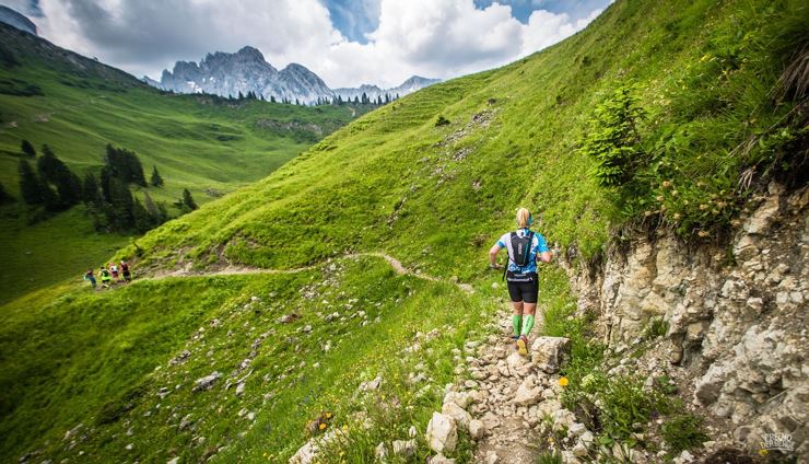
"GEIL, OWA ZACH" is the motto of the unique ultra run at the 50th anniversary of the Koasa March 2020.

  • Type: Running
  • Start: School centre Ebbs
  • End: School centre Ebbs
  • Difficult
  • 3450 m
  • 52.4 km

KUFSTEIN: Höhenweg to Schwoich Closed

The Höhenweg from Kufstein (Gewerbepark Süd) to Schwoich (Moosham) via Wöhrer Köpfl is closed until further notice due to fallen trees. There is currently no detour available.

THIERSEE: Connection from Hinterthiersee to Schmiedtal Closed

The path from Hinterthiersee to Schmiedtal is closed with immediate effect until further notice due to a dilapidated bridge. It is NOT permitted to cross the bridge. The path can be bypassed via Schmiedtal 45-48.

LANGKAMPFEN: Trail between Maistall and Dreibrunnenjoch

The trail between Maistall and Dreibrunnenjoch is permanently closed and not passable. Additionally, a bridge is in poor condition. A detour is possible via the steep trail at Stimmersee directly to Dreibrunnenjoch or via the forest road.

Classification of Hiking and Mountain Trails

Classification of Hiking and Mountain Trails

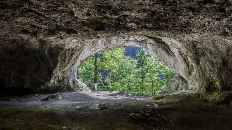
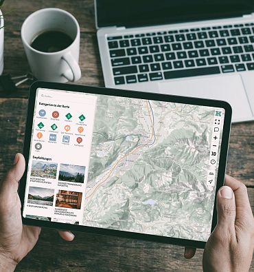
In addition to uniform signage and trail marking, hiking trails are generally divided into three difficulty levels: Hiking Trails, Mountain Trails, and Alpine Routes. The classification follows the Tyrolean Hiking and Mountain Trail Concept of the state of Tyrol.

Hiking Trail:
No mountain experience or specific mountain equipment is required for hiking trails. The paths are wide and without significant inclines or declines. The signage has a yellow background with a white circle indicating the difficulty level. Hiking trails are suitable for beginners and casual walkers. Sports shoes and weather-appropriate clothing are required.
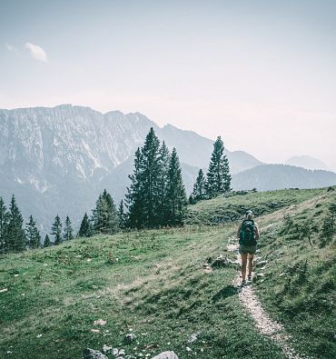
Red Mountain Trail:
Red mountain trails are moderately difficult. Some narrow and steep, but secured, walking and climbing passages await hikers. The corresponding signs have a yellow background with a red circle indicating the difficulty level. Red mountain trails are suitable for sure-footed and experienced mountain hikers. Good physical condition, mountain experience, and mountain equipment are required.

Black Mountain Trail:
Black mountain trails are narrow, almost entirely steep, and exposed paths. Those venturing on a black mountain trail must expect longer secured walking and climbing passages. Black mountain trails are indicated on yellow background signs with a black circle indicating the difficulty level. Black mountain trails are suitable for experienced, sure-footed, and alpine-experienced mountaineers. Excellent physical condition, alpine experience, and mountain equipment, including alpine safety gear, and good weather conditions are required.

Alpine Route:
Alpine routes are very difficult and not for everyone. They are located in high alpine terrain, are exposed, and feature unsecured walking and climbing passages. There is a significant risk of falling, as alpine routes can be slippery in parts. The signage carries the inscription "Alpine Route" as the difficulty level. Alpine routes are suitable for experienced, sure-footed, and highly alpine-experienced mountaineers. Outstanding physical condition, extensive mountain experience, alpine climbing equipment, safety and orientation tools, and good weather conditions are required.

Tyrolean Mountain Sports Guide

Tyrolean Mountain Sports Guides

With professional guidance, you can be sure of your safety: Around 1,200 mountain hiking guides and more than 700 top-trained mountain guides are available in Tyrol, offering maximum safety in the mountains. The Tyrolean mountain sports guides know every corner of the Tyrolean mountains and accompany hikers and mountaineers on their tours through the alpine mountain world. They ensure that everyone safely reaches the summit.

Mountain Rescue Tyrol

Mountain Rescue Tyrol

Professional assistance in alpine terrain. More than 4,000 mountain rescuers are on duty in the Tyrolean mountains for you. 365 days a year, 24 hours a day.

Ways to report an emergency in an alpine accident:

  • Emergency app
  • Alpine emergency number 140
  • Euro emergency number 112

No Signal? Without network coverage and in radio shadow, no emergency call is possible. Move to a better location and regularly dial the Euro emergency number 112. Access any available network by entering "112" instead of the PIN code when switching on the phone or using the SOS emergency call function.

Emergency App Mountain Rescue Tyrol:
An alternative to reporting emergencies in the terrain is the Emergency App Mountain Rescue Tyrol operated by Leitstelle Tirol for smartphones. The (almost) pinpoint location of the victim using the integrated GPS module drastically reduces the time between alert and rescue. At the same time, the phone connection allows for clarifying the emergency situation and supporting the victim in managing the acute situation. Thus, the Emergency App Mountain Rescue Tyrol is a valuable supplement to the official alpine emergency number 140 and can even save lives in some cases.

You can download the Emergency App Mountain Rescue Tyrol for iPhones from the Apple App Store or for Android smartphones from the Google Play Store for free.

Overview of the Mountain Rescue Tyrol Emergency App:

  • Developed specifically for emergencies in the alpine area within Tyrol
  • Usable only in Tyrol
  • The only emergency app directly connected to Leitstelle Tirol
  • Transmits the user's location (GPS coordinates) and personal data (via Internet or SMS) to Leitstelle Tirol at the push of a button in an acute emergency
  • Simultaneously establishes a phone connection with Leitstelle Tirol to clarify the situation
  • Subsequently, Leitstelle Tirol alerts and dispatches the necessary rescue forces
  • Includes a test function that allows you to test the functionality of data transmission and phone connection without triggering a false alarm

Proper Conduct in the Mountains

Proper Conduct in the Mountains

While hiking, weather conditions are felt much more strongly and directly than in the valley. Good tour planning and adherence to important behavioral rules significantly increase safety in the mountains. To ensure that hikers and mountaineers are safe in the mountain world, the Austrian Alpine Club has issued 10 recommendations for safe mountain hiking.

Proper Conduct with Grazing Animals

Proper Conduct with Grazing Animals

Austria's farmers make an important contribution to preserving our alpine landscape. However, an alpine pasture is not a petting zoo. By following a few simple behavioral rules, dangerous situations can be avoided when encountering grazing animals.

Hiking with Dogs

Hiking with Dogs

Alpine pastures are particularly rewarding hiking destinations for many people. To ensure that your time there remains a pleasant memory, it is important to follow some behavioral rules when dealing with grazing animals. This is especially true when hiking with a dog.

Hiking with a dog is a great experience and a true enrichment for both humans and animals. To ensure that both the dog and the owner can enjoy their hikes without worry, a dedicated hiking guide for "Hiking with Dogs" is available in Kufsteinerland:

Share with
your friends

Please wait

Information loading...